
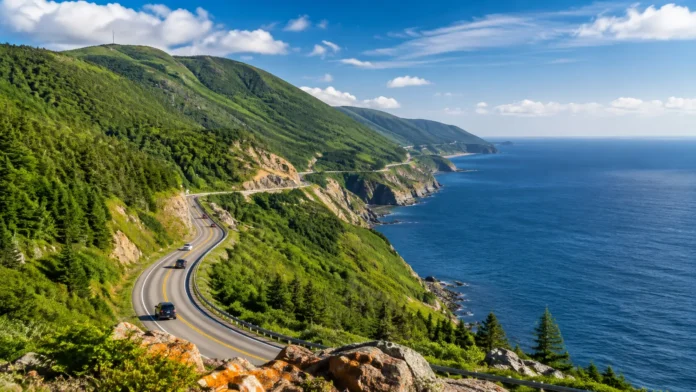

Cabot Trail, Nova Scotia: Best Stops & Scenic Drive Guide
The Cabot Trail is one of those road trips where the journey itself becomes the main attraction. Winding through northern Cape Breton Island in Nova Scotia, the route brings together rugged coastline, forested highlands, fishing communities, beaches, waterfalls, hiking trails, and constantly changing ocean views. Much of the most dramatic scenery unfolds around Cape Breton Highlands National Park, where the road climbs high above the coast before descending toward small communities beside the sea. Travelers can stop for short walks, longer hikes, seafood, photography, cultural experiences, and quiet viewpoints along the way. Although it is possible to complete the drive relatively quickly, rushing misses much of what makes the route special.
Planning a Cabot Trail road trip becomes easier when you think of it as a collection of experiences rather than a checklist of attractions. Chéticamp offers Acadian culture and access to the western side of the national park, while Pleasant Bay provides a peaceful coastal break farther north. Cape North makes a useful base for exploring the northern tip of Cape Breton, and Ingonish combines beaches, hiking, and dramatic eastern coastal scenery. Baddeck is another popular gateway because of its central location and waterfront atmosphere. Between these communities are countless look-offs where the scenery can suddenly become the highlight of your day. This guide covers the best Cabot Trail stops, scenic viewpoints, driving strategies, seasonal considerations, and practical tips for building a memorable Cape Breton road trip.
Why the Cabot Trail Is Worth the Drive
The Cabot Trail stands out because its scenery changes repeatedly within a relatively compact road trip. One moment you may be driving beside calm water and small fishing communities, while the next section climbs through dense forest toward exposed highland viewpoints. The western side offers dramatic views toward the Gulf of St. Lawrence, and the eastern side delivers rugged Atlantic scenery, coves, beaches, and steep green hills. Inland sections pass through valleys and forest where the experience feels completely different from the exposed coastline. This constant variation prevents the drive from becoming repetitive. Even travelers who are not enthusiastic hikers can experience much of Cape Breton’s landscape simply by using roadside look-offs and taking short walks near the highway.
Cape Breton Highlands National Park is one of the main reasons the Cabot Trail has become so famous. The road passes directly through spectacular highland terrain where steep slopes descend toward the sea and river valleys cut deeply through the landscape. Numerous hiking opportunities lead away from the road, ranging from easy nature walks to more demanding climbs. Wildlife may also appear along quieter sections, although animals should always be observed from a safe distance without stopping unsafely on the roadway. The park changes character with weather and season, meaning the same viewpoint can feel completely different under clear skies, coastal fog, autumn color, or evening light. This natural variety gives photographers and outdoor travelers plenty of reasons to slow down.
Another reason to drive the Cabot Trail is the collection of communities surrounding the highlands. Chéticamp reflects Cape Breton’s Acadian heritage through language, music, food, crafts, and local traditions. Communities around the northern section preserve strong connections with fishing and rural coastal life, while Ingonish has long attracted visitors to the island’s eastern shore. The route therefore feels more meaningful when you stop in villages instead of treating them merely as places to refuel. Local cafés, seafood restaurants, bakeries, galleries, and seasonal businesses can turn an ordinary meal break into part of the travel experience. Spending money locally also helps support communities that contribute much of the character travelers associate with Cape Breton Island.
The Cabot Trail is especially rewarding for travelers who enjoy combining driving with outdoor activities. You can spend one morning hiking to a highland viewpoint, stop beside a beach during the afternoon, and finish the day watching evening light settle across the coast. Kayaking, cycling, whale-watching excursions, camping, and nature photography may also fit into a longer itinerary depending on season and local availability. Those who prefer a slower trip can spend more time walking through villages, visiting artisan shops, and enjoying scenic picnic spots. Because the route supports several travel styles, couples, families, photographers, hikers, and relaxed road trippers can build very different itineraries around the same scenic loop.
Most importantly, the Cabot Trail rewards flexibility. Weather can change quickly along coastal and highland sections, so the viewpoint you planned to photograph may be covered in mist while another part of the route unexpectedly sits beneath brilliant sunlight. A flexible itinerary lets you stop when scenery looks particularly good instead of racing toward predetermined attractions. It also provides time for roadside look-offs you may not have noticed during trip planning. Avoid scheduling every hour of the day because the road naturally encourages spontaneous stops. The best Cabot Trail experiences often happen between famous destinations, when a curve reveals an unexpected coastline, a quiet trail invites exploration, or a small community becomes an unplanned lunch stop.
Best Stops From Baddeck to Chéticamp
Baddeck makes a convenient starting or finishing point for many Cabot Trail road trips. Located beside the Bras d’Or Lake, the village has a relaxed waterfront setting that works well for an overnight stay before tackling the scenic loop. Visitors can walk around the village, enjoy views across the water, browse local shops, or explore the area’s connection with Alexander Graham Bell. Baddeck also has restaurants, accommodations, and services that make preparing for the drive relatively easy. Starting here gives you several options for approaching the Cabot Trail depending on the direction you choose. Even if you do not stay overnight, allowing some time to explore Baddeck adds a different lakeside atmosphere to a trip dominated by coastal highlands.
Heading toward the western side of Cape Breton brings travelers into the Margaree area, where the scenery becomes gentler and more pastoral before reaching the dramatic coastline. The Margaree River and surrounding valley are known for beautiful rural landscapes, forested hills, farmland, and a slower pace that contrasts with the cliffs ahead. This portion of the trip is worth appreciating rather than treating as transportation between Baddeck and Chéticamp. Small roads, river views, cafés, and countryside scenery can provide pleasant stops along the way. Travelers interested in fishing, photography, or quiet landscapes may particularly enjoy spending extra time here. The valley also creates a natural transition between the Bras d’Or region and Cape Breton’s more exposed western coast.
Chéticamp is one of the most useful places to spend time during a Cabot Trail itinerary. This Acadian community sits close to the western entrance of Cape Breton Highlands National Park and offers accommodations, food, fuel, shops, and access to several outdoor experiences. The waterfront and surrounding coastline create attractive evening scenery, making Chéticamp a practical overnight base rather than simply a lunch stop. Travelers can also discover local crafts and traditions that reveal another side of Cape Breton beyond its famous landscapes. If you enjoy seafood, this is an excellent place to look for local seasonal dishes. Spending a night here allows you to begin exploring the national park early the next morning without completing a long drive first.
The coastline around Chéticamp becomes increasingly dramatic as you approach the highlands. Before rushing into the national park, watch for safe pull-offs and coastal areas where you can appreciate the transition from village landscapes to towering cliffs. Evening can be especially beautiful along the western coast when weather conditions create warm light across the water. A slower schedule also gives you an opportunity to explore nearby beaches or short coastal walks rather than immediately continuing north. The combination of open water and rising highlands creates some of the classic scenery associated with Cabot Trail photography. Always use designated parking areas instead of stopping abruptly on narrow shoulders when an impressive view appears.
Travelers spending more than one day around Chéticamp can use the community as a base for hiking and exploring the western portion of Cape Breton Highlands National Park. This approach reduces the pressure to see every major attraction during one continuous loop. You might dedicate one day to the village and nearby coast, then enter the park early the following morning for hikes and look-offs. A slower pace is particularly useful during busy travel periods when popular parking areas may require extra planning. It also leaves room for changing weather, which can dramatically affect highland visibility. Building one flexible overnight stop into the western side of the Cabot Trail often makes the entire road trip feel less rushed and much more enjoyable.
Cape Breton Highlands National Park Stops You Shouldn’t Miss
The western entrance to Cape Breton Highlands National Park introduces some of the route’s most impressive scenery almost immediately. As the highway begins climbing above the coast, views open toward the sea and surrounding highlands. Several designated look-offs provide safer opportunities to stop than attempting to pull onto narrow roadside shoulders. These overlooks are worth using even if you plan to hike later because each reveals a different perspective on the landscape. Clouds and fog can move through quickly, occasionally hiding the coastline before clearing again minutes later. Keep your camera accessible, but focus equally on enjoying the scenery without feeling obligated to photograph every curve.
The Skyline Trail is one of the best-known hikes along the Cabot Trail and is popular because it offers sweeping highland and coastal views without requiring technical hiking skills. The trail crosses exposed plateau landscapes before reaching viewpoints above the Gulf of St. Lawrence, creating one of Cape Breton’s most recognizable scenes. Because this is a heavily visited area, planning ahead is important during busy seasons, and seasonal parking or access procedures may apply. Allow enough time to walk at a comfortable pace rather than treating the trail as a quick roadside stop. Weather can change rapidly on exposed terrain, so appropriate footwear, layers, water, and awareness of current conditions make the experience more comfortable.
MacKenzie Mountain and nearby highland look-offs provide some of the most memorable driving views on the Cabot Trail. From elevated sections of the road, travelers can appreciate how dramatically the highway curves through forested slopes toward distant coastline. These locations are particularly appealing to travelers who want panoramic scenery without committing to a long hike. Stop only in designated areas and take extra care when entering or leaving parking spaces because traffic may be moving around steep curves. On clear days, the scale of the surrounding highlands becomes especially impressive. During autumn, the combination of winding road, colorful forest, and distant water creates some of the most photographed landscapes on Cape Breton Island.
Shorter nature stops are useful for balancing demanding hikes with easier sightseeing. Waterfalls, forest trails, lakes, beaches, and interpretive areas throughout the national park allow visitors to experience environments that are easy to overlook when concentrating entirely on ocean viewpoints. Beulach Ban Falls is one example of the type of accessible natural feature that can break up a long driving day. Forest walks also reveal mosses, streams, mature trees, and sheltered landscapes quite different from the windswept cliffs. Choosing one or two short stops between major attractions keeps the day interesting without creating an exhausting schedule. These smaller experiences often become memorable precisely because they offer peaceful contrast to the most famous viewpoints.
Plan more time for the national park section than its road distance might suggest. Driving speed naturally becomes slower on winding and mountainous sections, and scenic look-offs can easily turn a brief stop into twenty minutes of photography and exploration. Hiking adds several more hours depending on the trails you choose, while beaches and picnic areas provide reasons to linger even longer. Attempting to combine multiple major hikes with the entire Cabot Trail loop in one day can feel unnecessarily rushed. Instead, prioritize one substantial outdoor experience and several shorter stops if your schedule is limited. Travelers with additional days can explore both western and eastern park sections more deeply without continually watching the clock.
Pleasant Bay, Cape North and Northern Cabot Trail Stops
Pleasant Bay is a small coastal community that makes a natural pause between the western highlands and northern Cape Breton. The surrounding landscape feels quieter than some of the busier areas near Chéticamp and Ingonish, giving travelers an opportunity to slow down beside the coast. Whale-watching excursions are associated with this area during suitable seasons, although schedules depend on weather and operators. Even without joining a tour, the village offers scenic surroundings and a chance to rest after driving through mountainous terrain. Travelers staying overnight can experience a much calmer atmosphere after day-trippers have continued around the loop. Pleasant Bay works particularly well for visitors who prefer small communities and nature over busy resort-style destinations.
As the road continues through the northern highlands, forest and mountain scenery become increasingly prominent. This portion of the Cabot Trail may feel more remote, so it is sensible to monitor fuel and avoid assuming every small community will have late-night services. The quieter environment is part of the appeal, especially for travelers seeking a less commercial road-trip experience. Designated viewpoints reveal inland valleys, highland plateaus, and geological features that differ from the open western coastline. Take advantage of these stops because the scenery changes significantly once the road begins descending toward the northeastern coast. Northern Cape Breton rewards travelers who appreciate landscapes beyond the most frequently photographed cliff views.
Cape North is an important crossroads for travelers interested in exploring beyond the main Cabot Trail. From this area, side trips lead toward communities and landscapes at the northern edge of Cape Breton Island. Spending additional time here makes sense if your itinerary includes hiking, beaches, coastal roads, or remote viewpoints beyond the standard loop. Services are more limited than in larger Nova Scotia destinations, so planning accommodation and meals ahead can make travel easier during busy periods. The atmosphere is quieter and more rural, which is precisely what many visitors appreciate. Instead of approaching Cape North as another attraction to check off, think of it as a gateway to the island’s less-developed northern landscapes.
Meat Cove is one of the most talked-about northern detours because of its remote coastal scenery and dramatic setting. Reaching it takes additional time away from the main Cabot Trail, and road conditions can vary, so travelers should check current local information before committing to the drive. The destination appeals most to visitors who enjoy rugged landscapes and are comfortable adding a slower side trip to their itinerary. It is not necessary for first-time visitors with limited time, especially if they already have several hikes planned. Those with two or more days around northern Cape Breton can consider it as part of a more adventurous route. Building extra time prevents the detour from turning into a stressful race back to the main highway.
Another advantage of spending time in northern Cape Breton is the opportunity to experience the region early in the morning or later in the evening. Daytime road-trip traffic often concentrates around the main park attractions, while staying locally lets you explore nearby scenery during quieter hours. Early light can create beautiful conditions across valleys and coastal landscapes, while evening offers a slower atmosphere in small communities. Overnight travelers also gain flexibility if fog or rain hides mountain views during part of the previous day. Instead of trying to force every stop into poor weather, you can wait and adjust. This flexibility is one of the strongest arguments for giving the Cabot Trail more than a single rushed day.
Best Stops From Neil’s Harbour to Ingonish
Neil’s Harbour provides a pleasant coastal stop on the eastern side of northern Cape Breton. The community has a working maritime character and offers attractive views around its harbour and coastline. It can make a convenient place to pause for food or simply stretch your legs after leaving the highland interior. The scenery here feels different from the towering western cliffs because villages and small coves become more prominent. Travelers interested in photography can find appealing combinations of fishing infrastructure, water, and rugged coastal surroundings. As with other communities on the Cabot Trail, seasonal opening hours vary, so avoid building an overly tight schedule around a single restaurant or business without checking ahead.
Black Brook Beach is another worthwhile stop as you continue toward the eastern side of Cape Breton Highlands National Park. Beaches provide a refreshing contrast to mountain viewpoints and allow travelers to experience the coastline at water level rather than always looking down from elevated roads. Depending on conditions, this can be a good location for a picnic, short walk, or simply a quiet break beside the ocean. Coastal weather may feel noticeably cooler than inland areas, so carrying an extra layer remains useful even during generally pleasant days. Avoid underestimating waves, currents, and changing conditions near exposed shores. A beach stop works particularly well between hikes because it lets tired legs recover without sacrificing scenery.
The eastern park section offers several opportunities to combine forest, freshwater, and ocean environments in a relatively small area. Short walks can be particularly valuable here because they allow you to explore without adding another major hike after a full day on the road. Freshwater Lake and nearby landscapes around Ingonish provide accessible ways to experience a different side of the national park. If you have more time, longer trails lead through headlands and forest toward broader coastal views. Instead of attempting every trail, choose based on weather, fitness, and the amount of daylight remaining. One enjoyable hike is usually better than three rushed walks completed simply because they appeared on an itinerary.
Ingonish is one of the main destinations on the eastern Cabot Trail and works well as an overnight base. The surrounding area combines beaches, hiking, coastal viewpoints, accommodations, restaurants, and access to some of Cape Breton’s most recognizable landscapes. Travelers who spend the night can enjoy the coast after many road trippers have continued south, then begin the following morning before the busiest hours. Ingonish Beach is an obvious place to include when weather is pleasant, but the wider area deserves more than a quick photo stop. Staying here also creates a balanced itinerary when paired with a night near Chéticamp, allowing travelers to explore both sides of Cape Breton Highlands National Park more thoroughly.
Cape Smokey and the coastal highway south of Ingonish continue delivering impressive scenery even after you have technically left some of the most famous national park viewpoints behind. Elevation changes create broad perspectives over the Atlantic and surrounding forest, particularly in clear weather. This section reminds travelers not to mentally finish the road trip too early. Scenic stretches continue toward St. Ann’s and eventually back toward the Baddeck area, depending on your chosen route. Give yourself enough daylight to enjoy these final landscapes instead of driving them in darkness because an earlier hike ran long. The eastern Cabot Trail deserves the same relaxed approach as the west, even though many online photographs emphasize the dramatic cliffs near Chéticamp.
Clockwise or Counterclockwise: Which Direction Is Better?
There is no universally correct direction for driving the Cabot Trail because both clockwise and counterclockwise routes offer excellent scenery. The better choice depends on where you are staying, which activities matter most, weather forecasts, and how you want to divide your overnight stops. Starting from Baddeck and traveling toward Margaree and Chéticamp creates a natural progression toward the dramatic western highlands. Going the opposite way brings you toward St. Ann’s and Ingonish before crossing the northern highlands and descending toward Chéticamp. Rather than choosing solely because someone claims one direction has superior views, build the route around your itinerary. You will encounter major look-offs from either direction and can safely stop at designated viewpoints.
Driving clockwise can work well if you want to spend your first night around Chéticamp and explore the western section of Cape Breton Highlands National Park early the following day. This strategy lets you settle into the road trip through the Margaree area before reaching the more dramatic coastal highlands. It is also useful if western sunsets are an important part of your photography plans. Travelers can stay near Chéticamp, hike the next morning, then continue through Pleasant Bay and the northern section toward Ingonish. Breaking the journey this way reduces pressure to drive the entire loop continuously. The main advantage is itinerary flow rather than any guarantee that every view will be better in one particular direction.
Counterclockwise driving may make more sense when your first major stop is Ingonish or when accommodations are available on the eastern side of the route. Starting with the Atlantic coast allows you to explore beaches and eastern park trails before climbing through the northern highlands. You can then finish the most dramatic western coastal section later in the journey before continuing toward Chéticamp and Margaree. This arrangement may also fit travelers arriving from eastern Cape Breton attractions before beginning the loop. Again, the decision should reflect where you slept the previous night and where you want to finish. Driving direction matters much less than having enough time to stop safely and enjoy the scenery.
If you only have one day, choose the direction that allows you to reach your highest-priority activity at the best time. Hikers may want to arrive at a popular trailhead earlier, while photographers might coordinate western viewpoints with later afternoon or evening light. Check the weather on both sides of the highlands because conditions can differ across relatively short distances. Fog covering one coast does not necessarily mean the entire loop will have poor visibility. Start with the side offering better conditions when your schedule permits. One-day travelers should also limit the number of lengthy hikes because completing the full scenic drive, stopping at look-offs, eating meals, and hiking can consume far more time than expected.
For a relaxed trip, spend at least two days experiencing the Cabot Trail region rather than concentrating entirely on driving direction. An overnight near Chéticamp followed by another around Ingonish or northern Cape Breton creates significantly more freedom for hiking and spontaneous stops. Travelers with three or four days can explore side roads, villages, beaches, cultural attractions, and additional trails without rushing. The Cabot Trail is not a racetrack where success depends on completing the circle quickly. Whether you travel clockwise or counterclockwise, a slower itinerary allows weather, light, and curiosity to influence your day. That flexibility contributes far more to the quality of the experience than deciding which direction supposedly provides the perfect road-trip perspective.
Best Time to Drive the Cabot Trail
Summer is one of the easiest seasons for a Cabot Trail road trip because daylight is long and tourism services are generally at their most active. Warmer temperatures make hiking, beach stops, outdoor dining, and coastal activities easier to combine within the same itinerary. This is also a popular travel period, so accommodations and major attractions can become busier. Booking lodging ahead is sensible if your dates are fixed, particularly when you want to stay in smaller communities with limited rooms. Early mornings can help you experience popular trails and look-offs before peak daytime activity. Even during summer, pack layers because coastal wind, fog, and mountain conditions can feel much cooler than sunny inland areas.
Early autumn is famous for colorful foliage across Cape Breton’s highlands. Forested mountains can develop vivid combinations of yellow, orange, red, and evergreen tones, dramatically changing the appearance of familiar Cabot Trail viewpoints. This beauty also attracts many visitors, particularly during peak color periods and seasonal events. If autumn foliage is the main reason for your trip, allow several days because color and weather are difficult to predict perfectly months in advance. Cool mornings and shorter daylight make careful scheduling more important than during midsummer. Pack warmer clothing and avoid assuming that pleasant afternoon weather will continue after sunset in elevated or exposed areas.
Late spring can provide a quieter Cabot Trail experience, with fresh green landscapes and fewer visitors than the busiest summer periods. However, seasonal businesses and attractions may operate on reduced schedules, and higher-elevation conditions can remain cooler. Hiking trails may also be wet after rain or spring thaw, making sturdy footwear especially useful. Travelers choosing this season should approach the trip with greater flexibility regarding restaurants and activities. The advantage is a calmer atmosphere and the opportunity to experience communities before peak-season traffic arrives. Always check current park, road, trail, and business information shortly before traveling because seasonal openings can vary from year to year.
Winter transforms the Cape Breton Highlands into a completely different environment and requires a very different style of trip. Snow, ice, strong wind, changing visibility, and limited seasonal services can make ordinary sightseeing more challenging. Travelers considering winter driving should have appropriate experience, a suitable vehicle setup, and up-to-date information about road and weather conditions. This is not the season for casually reproducing a summer Cabot Trail itinerary with the same stops and timetable. Some accommodations, restaurants, attractions, and visitor services may be unavailable or reduced. For most first-time visitors focused on scenic driving and hiking, the warmer months provide a more straightforward introduction to the region.
Regardless of season, weather should remain part of your daily planning. Coastal fog can hide viewpoints, rain can make trails slippery, and wind can significantly change how comfortable exposed locations feel. Check conditions before leaving your accommodation and be willing to rearrange hikes or stops if necessary. Carry layers, rain protection, drinking water, and suitable walking shoes even when the morning begins with clear skies. Avoid trying to force a major hike during unsuitable weather simply because it was scheduled months earlier. Cape Breton’s changing conditions are part of the landscape, and a flexible traveler can often find enjoyable alternatives until visibility or weather improves elsewhere along the route.
Cabot Trail Driving Tips for a Better Road Trip
Begin each day with enough fuel, especially before entering quieter sections of northern Cape Breton. Although communities exist throughout the region, fuel stations and businesses are not distributed like they would be around a major city, and opening hours may vary seasonally. Keep your phone charged and consider carrying a vehicle charger because navigation, photography, and searching for local information can drain batteries quickly. Download useful information before traveling through areas where mobile reception may be inconsistent. A small supply of water and snacks can also make delays more comfortable. Basic preparation allows you to enjoy remote scenery without constantly worrying about finding the next service station.
Drive conservatively on mountainous sections and resist the temptation to watch the scenery while the vehicle is moving. Cabot Trail curves, elevation changes, wildlife, cyclists, weather, and unfamiliar road conditions require consistent attention from the driver. Use designated look-offs when you want to admire or photograph a view rather than slowing unpredictably in the traffic lane. If you are traveling with another person, let the passenger handle photography and navigation. Motorcyclists and cyclists also share sections of the route, so leave appropriate passing distance and remain patient. The goal is not to cover the route quickly but to reach every stop safely while enjoying one of Canada’s most scenic drives.
Plan fewer major activities than you initially think you can complete. Online itineraries sometimes make viewpoints, villages, meals, waterfalls, beaches, and hikes appear close enough to combine effortlessly, but each stop requires parking and walking time. A ten-minute photo stop can become thirty minutes when the light is beautiful, and lunch may take longer during busy periods. Hiking introduces even more variability because trail conditions and individual walking pace differ. Select two or three priorities for each day and treat everything else as optional. This approach reduces disappointment and gives you enough flexibility to enjoy unexpected discoveries without feeling that they are making you late.
Accommodation location can significantly improve a Cabot Trail itinerary. Instead of staying far away and driving into the highlands each morning, consider sleeping near the section you plan to explore the following day. Chéticamp works well for the western side, while Ingonish is convenient for eastern park attractions. Pleasant Bay, Cape North, and other northern communities appeal to travelers who want quieter surroundings and easier access to remote landscapes. Baddeck provides useful services and works particularly well before or after completing the loop. Choosing accommodation strategically reduces repeated driving and helps you reach popular outdoor areas earlier when parking and conditions may be more favorable.
Finally, leave room for the Cabot Trail to surprise you. Scenic road trips become less enjoyable when every stop is dictated by a rigid spreadsheet or an attempt to reproduce someone else’s photographs. One traveler may remember the Skyline Trail most clearly, while another may prefer an empty beach, a bowl of seafood in Chéticamp, or evening light around a quiet harbour. Stop where you are curious, spend longer where you feel relaxed, and skip attractions that do not match your interests. The Cabot Trail offers enough variety that there is no single perfect itinerary. A successful trip balances preparation with spontaneity, allowing Cape Breton’s landscapes and communities to shape part of the journey naturally.
Conclusion
The Cabot Trail is one of Nova Scotia’s most rewarding scenic drives because it combines dramatic landscapes with communities, outdoor activities, and cultural experiences. The journey moves between forested highlands, coastal cliffs, river valleys, beaches, fishing villages, and panoramic look-offs without requiring travelers to leave the main region. Cape Breton Highlands National Park provides many of the most famous views, but the places surrounding it are equally important to the character of the trip. Chéticamp, Pleasant Bay, Cape North, Ingonish, Margaree, and Baddeck each contribute something different. Giving yourself time to experience these communities transforms the drive from sightseeing into a more complete Cape Breton journey.
For first-time visitors, the best Cabot Trail stops usually combine a few iconic locations with less demanding roadside experiences. The Skyline Trail provides a classic highland perspective, while scenic mountain look-offs deliver impressive views without requiring hours of hiking. Beaches, waterfalls, forest walks, and quiet communities create useful breaks between longer activities. Chéticamp and Ingonish make particularly practical bases if you want to divide exploration between the western and eastern sides of the national park. Northern Cape Breton deserves additional time if remote scenery appeals to you. Instead of trying to see every named attraction, choose a mixture of experiences that matches your interests and available energy.
Driving clockwise or counterclockwise matters less than creating a sensible itinerary with enough time for stops. Both directions reveal impressive scenery, and either can work well depending on accommodation, weather, and your highest-priority activities. A one-day loop is possible for travelers primarily interested in driving and short stops, but it leaves relatively little space for major hikes and spontaneous exploration. Two or more days create a much better balance between driving and actually experiencing the region. Longer stays also give you another opportunity if fog hides a viewpoint or weather disrupts hiking plans. The ability to adjust is especially valuable in Cape Breton’s changeable coastal environment.
Season also shapes the experience significantly. Summer provides long daylight and easier access to a broad range of activities, while autumn can cover the highlands in remarkable foliage. Spring offers quieter roads but may require greater flexibility around seasonal services, and winter demands substantially more preparation for road and weather conditions. Regardless of when you visit, pack layers and check current conditions before entering exposed highland areas. Book important accommodation ahead when traveling during popular periods. Thoughtful preparation helps prevent logistical issues from distracting you from the scenery that brought you to Cape Breton in the first place.
Ultimately, the best Cabot Trail road trip is not the one that collects the greatest number of stops. It is the one that gives you enough time to pull into an unexpected look-off, walk beside the ocean, explore a village, enjoy local food, and watch the landscape change as the highway climbs into the highlands. Treat the route as a destination rather than transportation between attractions. Drive safely, stay flexible, and allow more time than the mileage seems to require. Whether your trip centers on hiking, photography, coastal scenery, food, or simply an unforgettable drive, the Cabot Trail offers plenty of reasons to slow down and experience Cape Breton Island at its own pace.
Frequently Asked Questions About the Cabot Trail
How long does it take to drive the Cabot Trail?
You can complete the main scenic loop in a day, but driving time alone does not account for viewpoints, meals, hikes, beaches, and village stops. Two or more days provide a much more relaxed experience if you want to explore Cape Breton Highlands National Park rather than simply drive through it.
Is it better to drive the Cabot Trail clockwise or counterclockwise?
Both directions offer excellent views, so choose according to your accommodation, weather, and preferred stops. Clockwise can work well when heading toward Chéticamp first, while counterclockwise is convenient if you want to explore Ingonish and the eastern side first.
What are the best stops on the Cabot Trail?
Popular stops include Chéticamp, the Skyline Trail area, highland look-offs, Pleasant Bay, Cape North, Neil’s Harbour, Black Brook Beach, Ingonish, and the surrounding Cape Breton Highlands National Park scenery. Baddeck and the Margaree area are also worthwhile additions when beginning or ending the trip.
What is the best time of year to drive the Cabot Trail?
Summer is excellent for long daylight, hiking, and outdoor activities, while early autumn is especially popular for colorful highland foliage. Late spring can be quieter, but travelers should check seasonal business, trail, and weather conditions before visiting.
Can you drive the Cabot Trail in one day?
Yes, but a one-day trip works best if you focus on scenic driving, several viewpoints, and perhaps one primary hike or activity. Spending two or three days gives you significantly more time for beaches, villages, hiking trails, meals, and spontaneous stops without rushing.